
| Weather and Climate Data | |||||||||||||
|
 |
|
| Maximum Potential Hurricane Intensity |
|||
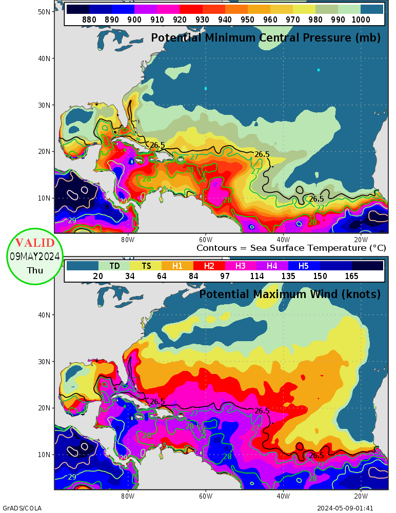
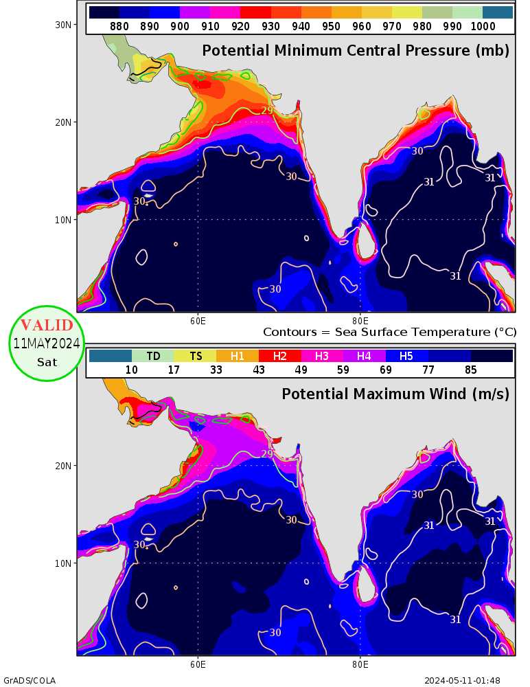
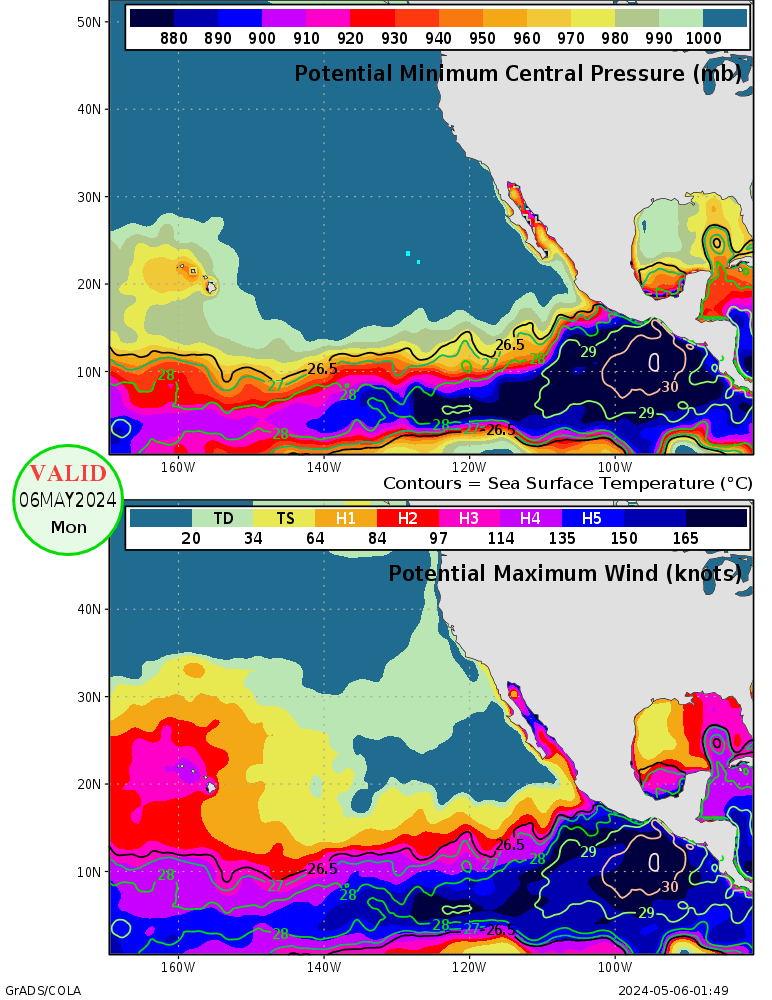
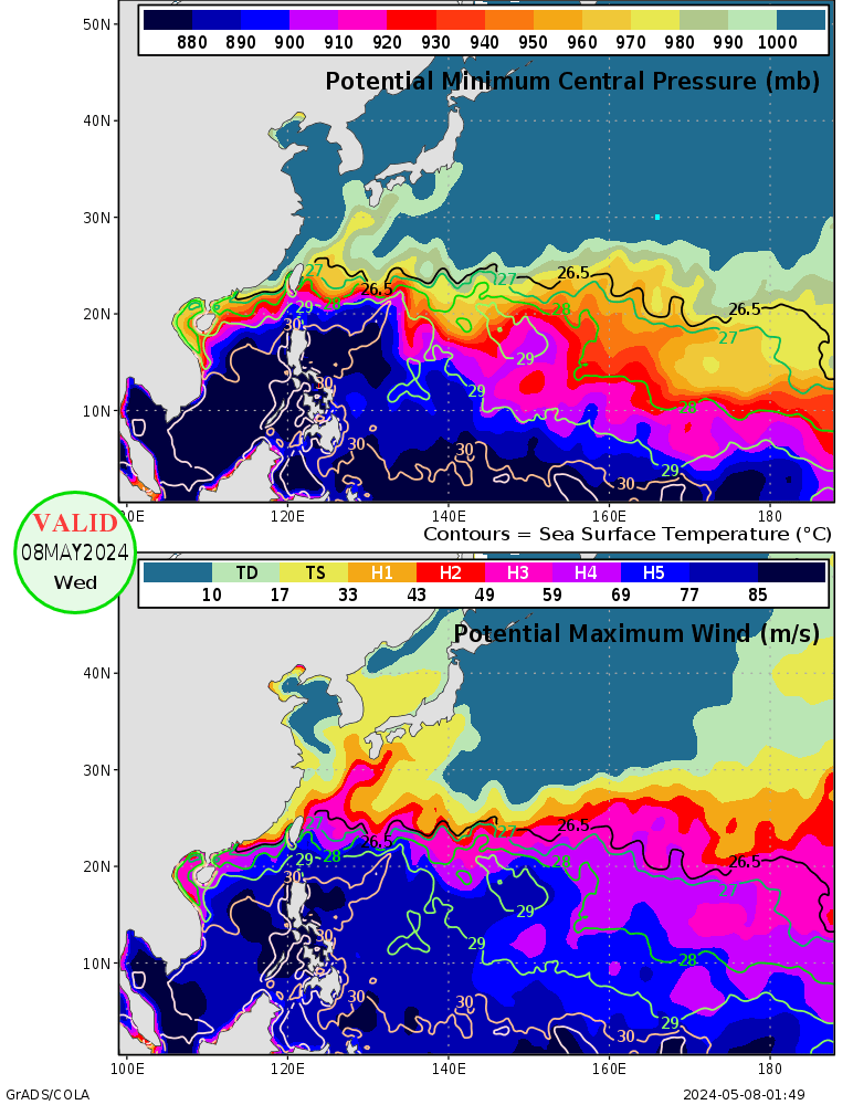
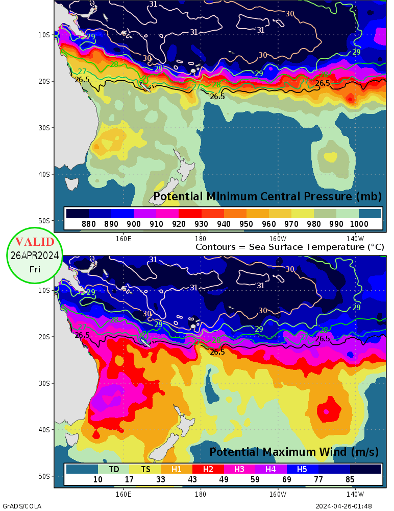
| The maps display potential minimum pressure and maximum winds, calculated according to a method developed by Dr. Kerry Emanuel. Dissipative heating is handled according to a method described in Bister and Emanuel (1998). The maps are based on data from the 00Z global operational analysis from NCEP for the date shown on the plot. The top panel shows the potential minimum central pressure for a hurricane at any given location (in millibars). Only values less than 1000mb are shaded. Cyan squares indicate grid points where the algorithm failed to converge. Also shown are the sea surface temperatures (°C). The bottom panel shows the potential maximum wind speed expressed in terms of the type and severity of storm they would represent (TD = Tropical Depression, TS = Tropical Storm, H1-H5 = Hurricanes of category 1-5 on the Saffir-Simpson scale). |
|||
 |
|||
 |
|||
 |
|||
| Eastern Pacific Ocean: |
|||
 |
|||
| Western Pacific Ocean: |
|||
 |
|||
| Southern Pacific Ocean: |
|||
 |